Tocht Stappen La Vancelle - Les Hauts de La Vancelle - Photo

Les Hauts de La Vancelle

 VacheKiri67
VacheKiri67

Gebruiker

© OpenStreetMap contributors
Lengte
Lengte
13,4 km
Max. hoogte
Max. hoogte
860 m
Positief hoogteverschil
606 m
Km-Effort
Km-Effort  
21 km
Min. hoogte
Min. hoogte
392 m
Negatief hoogteverschil
607 m
Boucle
Boucle
Ja
Datum van aanmaak :
2020-06-01 07:52:57.795
Laatste wijziging :
2020-06-01 16:25:36.583

(0 Bericht)

Stappen
Stappen
4h39
Moeilijkheid : Medium

Scan deze QR-code om de tocht te openen in de SityTrail-applicatie

Gratisgps-wandelapplicatie

Logo SityTrail SityTrail

IGN / Geografische instituten

SityTrail uit de App Store downloaden SityTrail uit Google Play downloaden

Logo SityTrail SityTrail Plus

De wereld gaat voor u open

SityTrail uit de App Store downloaden SityTrail uit Google Play downloaden SityTrail op Huawei AppGallery downloaden

Over ons

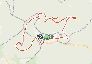
Tocht Stappen van 13,4 km beschikbaar op Grand Est, Bas-Rhin, La Vancelle. Deze tocht wordt voorgesteld door VacheKiri67.

Beschrijving

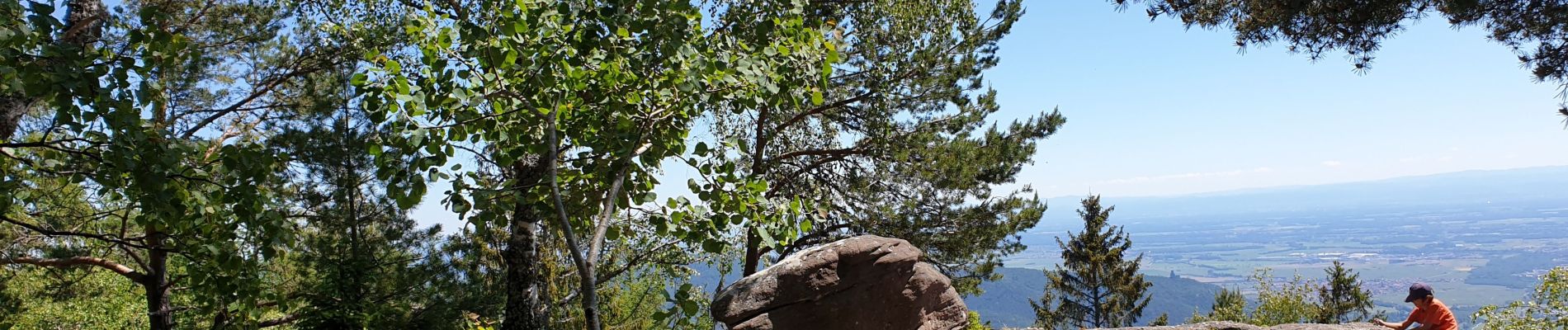
Faite le 01/06/2020. D'après "Passion Vosges - Escapade en Alsace Centrale" N°9 :  Les Hauts de La Vancelle. Durée indiquée pour le circuit : 4h30. Départ : La Vancelle, parking. La Vancelle - Chalmont - rocher du Coucou - château du Frankenbourg - La Vancelle.
La difficulté du parcours est le sentier croix rouge avec  120m sur une distance de 500m.
Très beau parcours.

Hoogteprofiel

Foto's

35 fotos in totaal. Klik op een foto om ze allemaal in de galerij weer te geven.

Plaatsbepaling

Land:
France
Regio :
Grand Est
Departement/Provincie :
Bas-Rhin
Gemeente :
La Vancelle
Locatie:
Unknown
Vertrek:(UTM)
374163 ; 5349292 (32U) N.


Sluiten
Mijn abonnementen